Cyclone Nisarga likely to cross close to Mumbai by June 3, predicts IMD
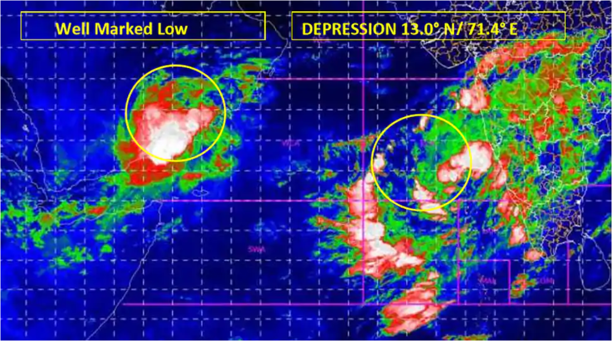
India Meterological Department (IMD) on Monday (June 1) said that the well-marked low-pressure area over the south-east and adjoining east-central Arabian Sea and Lakshadweep area concentrated into a depression on Monday morning.
According to IMD, the depression is located about 370 kilometres (km) southwest of Panjim; 690 km south-southwest of Mumbai and 920 km south-south-west of Surat. It is expected that the depression would intensify into a deep depression over the next 12 hours and into severe cyclonic storm Nisarga by Wednesday (June 3).
IMD’s cyclone track showed that cyclone Nisarga will cross very close to the Mumbai coast while entering the land. Maharashtra and Gujarat have been placed on pre-cyclone alert as some parts of these states are forecast to receive very heavy to extremely heavy rainfall on Wednesday and Thursday.
The IMD predicted that initially Nisarga would move towards northwards till Tuesday morning and then recurve north-northeast wards and cross north Maharashtra and south Gujarat coasts between Harihareshwar (Raigad, Maharashtra) and the union territory of Daman on Wednesday evening. When it crosses the coast as a severe cyclonic storm it will have a wind speed of 105 to 115 km per hour (kmph) which may increase to 125 kmph. Konkan, Goa, parts of Maharashtra and Gujarat are expected to receive very heavy to extremely heavy rain till Thursday.
Fishermen have been advised not to venture into the south-east Arabian Sea, Lakshadweep area and along and off Kerala coast during next 48 hours; the east-central Arabian Sea and along and off Karnataka-Goa coasts till Wednesday; the east-central Arabian Sea along and off Maharashtra coast and the north-east Arabian Sea along and off Gujarat coast on Wednesday and Thursday because the sea is expected to be very rough.
“We’re expecting rapid intensification of the cyclonic system once formed, because sea surface temperature is high, wind shear (variation in wind velocity) is low and ocean heat potential is also high,” said Sunita Devi, who is in-charge of cyclones at IMD, on Sunday.


